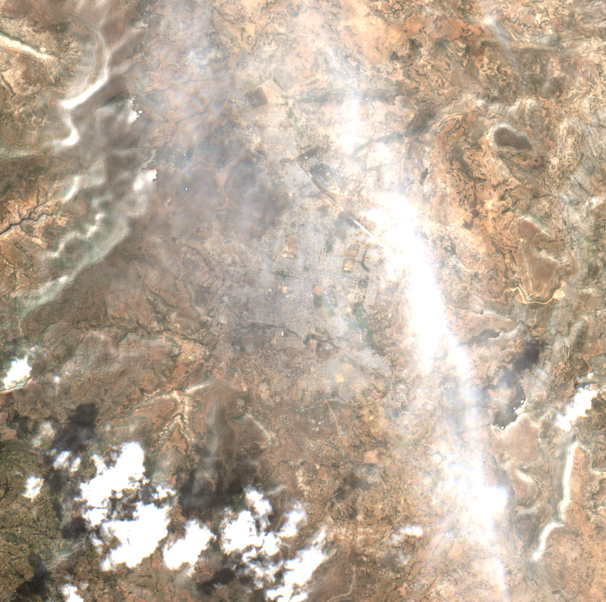
ይህ ሊያሳየው የሚችለው እና የማይችለው። Sentinel-2 true colour at ten metres per pixel, acquired about five hours after the time residents describe. A military lorry covers about a quarter of one pixel, so no column of vehicles on a road can be resolved at this scale whatever the weather. On top of that limit, the scene classification band flags 41.4 per cent of this area as cloud or cloud shadow, including the road corridor north-east of the town — the scene is listed as 11.8 per cent cloud, but that figure is for the whole hundred-kilometre tile, not for here. Nothing should be read into this image either way.
ሪፖርት — Al Jazeera carrying Reuters, 7 October. At least three Adigrat residents describe dozens of soldiers in two lorries driving through the town on Wednesday, identified by off-white camouflage uniforms. Reuters states it could not independentl
በማህደር የተቀመጠ ቅጂ
ሪፖርት — Africanews, 7 October, on the reported deployment. Carried here as a second publication of the Reuters account, not as corroboration of it.
በማህደር የተቀመጠ ቅጂ
ሪፖርት — BBC reporting of 7 October, retrieved via Yahoo syndication. Residents describe convoys of between twenty and sixty lorries carrying Eritrean registration plates; a resident of Edaga Hamus reports troops passing and drone strikes nearby. Qu
በማህደር የተቀመጠ ቅጂ
ምርምር — ACLED expert comment of 7 October by Dr Jalale Getachew Birru, Regional Expert for East Africa. States that Eritrean forces crossed at Zalambessa and moved along the Adigrat-Idaga Hamus road, and that Ethiopian drones targeted them at Guada
በማህደር የተቀመጠ ቅጂ
የሙቀት — NASA FIRMS active-fire detections within 75 km of Adigrat for 30 September to 7 October 2026, from the open seven-day global VIIRS products (375 m, NOAA-20 and S-NPP) and MODIS (1 km). Total detections in that radius across all three sensor
ከተመዘገበ ጥያቄ እንደገና የተፈጠረ
ምርምር — Critical Threats Project Africa File, 8 October 2026. States that satellite imagery from 8 October showed a destroyed truck on the road between Adigrat and Idaga Hamus, "confirming ACLED and AFP reporting and at least one of the videos clai
በማህደር የተቀመጠ ቅጂ
ጥልቅ ዳሰሳ
ምንጮች እና ቴክኒካዊ መነሻ
Al Jazeera
Al Jazeera carrying Reuters, 7 October. At least three Adigrat residents describe dozens of soldiers in two lorries driving through the town on Wednesday, identified by off-white camouflage uniforms. Reuters states it could not independently verify the accounts.
BBC reporting of 7 October, retrieved via Yahoo syndication. Residents describe convoys of between twenty and sixty lorries carrying Eritrean registration plates; a resident of Edaga Hamus reports troops passing and drone strikes nearby. Quotes Ethiopian minister Abraham Belay saying the Eritrean army has participated with its full capacity and logistics. The BBC states it has not independently verified the images circulating on social media, nor any of the reported troop movements.
ACLED expert comment of 7 October by Dr Jalale Getachew Birru, Regional Expert for East Africa. States that Eritrean forces crossed at Zalambessa and moved along the Adigrat-Idaga Hamus road, and that Ethiopian drones targeted them at Guada as they travelled towards Idaga Hamus. Attributes to Eritrea the aims of weakening the Ethiopian government and eliminating the TPLF over grievances from the last war, and of preventing Ethiopian forces reaching the Eritrean border.
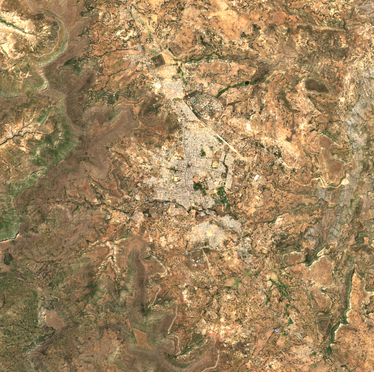
Sentinel-2 true colour over Adigrat, 1 October 07:56Z, six days before the reported movement. Cloud-free over the area: nothing in the scene classification band is flagged as cloud or shadow.
Technical provenance
Captured at
2026-10-01 07:56:00+00:00
Timestamp basis
platform
Licence
Copernicus Sentinel data 2026, processed by ESA. Free and open under the Copernicus licence; redistribution permitted with attribution.
Reproduction procedure
earth-search sentinel-2-l2a, scene S2A_37PER_20261001_0_L2A, windowed to a 12 km box centred on 14.2774, 39.4615.
Upstream sources
["Element 84 Earth Search v1 / AWS Open Data sentinel-cogs"]
["earth-search STAC query (sentinel-2-l2a)", "windowed read of asset 'visual' at native resolution (EPSG:32637)", "bands 1-3 as RGB", "PNG encode"]
Bbox
[39.405, 14.223, 39.518, 14.331]
Crs
EPSG:4326
Resolution m
10.0
Cloud cover pct
0.6
License
Copernicus Sentinel data 2026, processed by ESA. Free and open under the Copernicus licence; redistribution permitted with attribution.
Redistributable
True
Detectability note
Sentinel-2 true colour at ten metres per pixel. A military lorry is roughly two and a half metres by nine, about a quarter of the area of one pixel, so neither a single vehicle nor a column of them can be resolved. This imagery could show a large vehicle park, new earthworks, a burn scar more than about thirty metres across, destroyed buildings, or a smoke plume caught at the moment of overpass. It cannot show a convoy on a road, and absence of change in it is not evidence that no convoy passed.
Satellite image · 7 Oct 2026
Sentinel-2 true colour over Adigrat, 7 October 08:06Z, the morning residents describe Eritrean lorries passing through the town. Published because we looked, not because it settles anything.
Technical provenance
Captured at
2026-10-07 08:06:00+00:00
Timestamp basis
platform
Licence
Copernicus Sentinel data 2026, processed by ESA. Free and open under the Copernicus licence; redistribution permitted with attribution.
Reproduction procedure
earth-search sentinel-2-l2a, scene S2B_37PER_20261007_0_L2A, windowed to a 12 km box centred on 14.2774, 39.4615.
Upstream sources
["Element 84 Earth Search v1 / AWS Open Data sentinel-cogs"]
["earth-search STAC query (sentinel-2-l2a)", "windowed read of asset 'visual' at native resolution (EPSG:32637)", "bands 1-3 as RGB", "PNG encode"]
Bbox
[39.405, 14.223, 39.518, 14.331]
Crs
EPSG:4326
Resolution m
10.0
Cloud cover pct
11.8
License
Copernicus Sentinel data 2026, processed by ESA. Free and open under the Copernicus licence; redistribution permitted with attribution.
Redistributable
True
Detectability note
Sentinel-2 true colour at ten metres per pixel, acquired about five hours after the time residents describe. A military lorry covers about a quarter of one pixel, so no column of vehicles on a road can be resolved at this scale whatever the weather. On top of that limit, the scene classification band flags 41.4 per cent of this area as cloud or cloud shadow, including the road corridor north-east of the town — the scene is listed as 11.8 per cent cloud, but that figure is for the whole hundred-kilometre tile, not for here. Nothing should be read into this image either way.
Fire-detection data
NASA FIRMS active-fire detections within 75 km of Adigrat for 30 September to 7 October 2026, from the open seven-day global VIIRS products (375 m, NOAA-20 and S-NPP) and MODIS (1 km). Total detections in that radius across all three sensors and the whole window: zero. The same files carry 8,573 detections inside Ethiopia over the window, 1,336 of them on 7 October, and 89 inside a wider Tigray box.
Technical provenance
Timestamp basis
unknown
Reproduction procedure
Stream the open seven-day global CSVs for noaa-20-viirs-c2, suomi-npp-viirs-c2 and modis-c6.1 from firms.modaps.eosdis.nasa.gov/data/active_fire/, filter to Ethiopia (lat 3.0-15.5, lon 32.5-48.5), then to within 75 km of 14.2774, 39.4615. No API key is needed. The window is ROLLING: after 2026-10-14 these files no longer cover 7 October.
Upstream sources
["NASA FIRMS"]
Satellite image · 1 Oct 2026
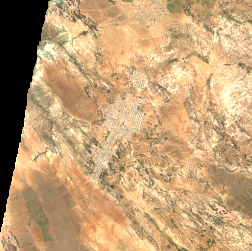
Sentinel-2 true colour over Zalambessa, the border town where ACLED places the crossing, 1 October 07:56Z. Nothing in this box is flagged as cloud or shadow.
Technical provenance
Captured at
2026-10-01 07:56:00+00:00
Timestamp basis
platform
Licence
Copernicus Sentinel data 2026, processed by ESA. Free and open under the Copernicus licence; redistribution permitted with attribution.
Reproduction procedure
earth-search sentinel-2-l2a S2A_37PES_20261001_0_L2A, 2.5 km radius on 14.5256, 39.3871
Upstream sources
["Element 84 Earth Search v1 / AWS Open Data sentinel-cogs"]
["earth-search STAC query (sentinel-2-l2a)", "window centred on Zalambessa, 2.5 km radius", "windowed read of asset 'visual' at native resolution (EPSG:32637)", "bands 1-3 as RGB", "PNG encode"]
Bbox
[39.363901, 14.503142, 39.410299, 14.548058]
Crs
EPSG:4326
Resolution m
10.0
Cloud cover pct
5.4
License
Copernicus Sentinel data 2026, processed by ESA. Free and open under the Copernicus licence; redistribution permitted with attribution.
Redistributable
True
Detectability note
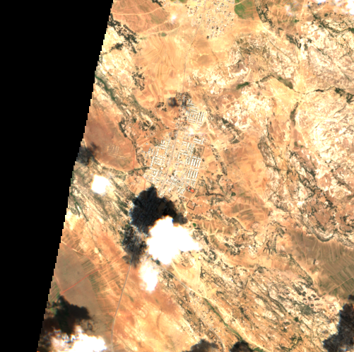
Sentinel-2 true colour at ten metres per pixel over a 5 km box on Zalambessa, the border town where ACLED places the crossing. These are the nearest clear views to the event, not views of it: on 7 October, the day Eritrean forces are reported to have come through, the scene classification layer flags one hundred per cent of this box as cloud. There is no imagery of the crossing and there will not be. What these frames show is the ground: the town strung along the road south, and the road itself. A lorry is about a quarter of one sample here, so no column of vehicles could be counted even on a clear day. The dark wedges at the edges are outside the satellite's swath for these granules and carry no data; they differ between the two dates, so nothing at the frame edges should be compared. The town itself is fully covered on both.
Satellite image · 4 Oct 2026
The same box on 4 October 07:55Z, three days before the reported crossing. 6.6 per cent of the box is flagged as cloud or shadow; the town is clear.
Technical provenance
Captured at
2026-10-04 07:55:00+00:00
Timestamp basis
platform
Licence
Copernicus Sentinel data 2026, processed by ESA. Free and open under the Copernicus licence; redistribution permitted with attribution.
Reproduction procedure
earth-search sentinel-2-l2a S2B_37PES_20261004_0_L2A, 2.5 km radius on 14.5256, 39.3871
Upstream sources
["Element 84 Earth Search v1 / AWS Open Data sentinel-cogs"]
["earth-search STAC query (sentinel-2-l2a)", "window centred on Zalambessa, 2.5 km radius", "windowed read of asset 'visual' at native resolution (EPSG:32637)", "bands 1-3 as RGB", "PNG encode"]
Bbox
[39.363901, 14.503142, 39.410299, 14.548058]
Crs
EPSG:4326
Resolution m
10.0
Cloud cover pct
27.9
License
Copernicus Sentinel data 2026, processed by ESA. Free and open under the Copernicus licence; redistribution permitted with attribution.
Redistributable
True
Detectability note
Sentinel-2 true colour at ten metres per pixel over a 5 km box on Zalambessa, the border town where ACLED places the crossing. These are the nearest clear views to the event, not views of it: on 7 October, the day Eritrean forces are reported to have come through, the scene classification layer flags one hundred per cent of this box as cloud. There is no imagery of the crossing and there will not be. What these frames show is the ground: the town strung along the road south, and the road itself. A lorry is about a quarter of one sample here, so no column of vehicles could be counted even on a clear day. The dark wedges at the edges are outside the satellite's swath for these granules and carry no data; they differ between the two dates, so nothing at the frame edges should be compared. The town itself is fully covered on both.
Criticalthreats
Critical Threats Project Africa File, 8 October 2026. States that satellite imagery from 8 October showed a destroyed truck on the road between Adigrat and Idaga Hamus, "confirming ACLED and AFP reporting and at least one of the videos claiming that Ethiopian drone strikes had targeted suspected Eritrean forces in the area". CTP and ISW geolocated media posted by pro-Ethiopian government accounts on 7 October to Idaga Hamus and that road, and determined the media was from no earlier than 2024, so not reused footage from the last war. CTP states it could not verify the exact time most of the media was captured, or whether the personnel and vehicles shown are Eritrean military.